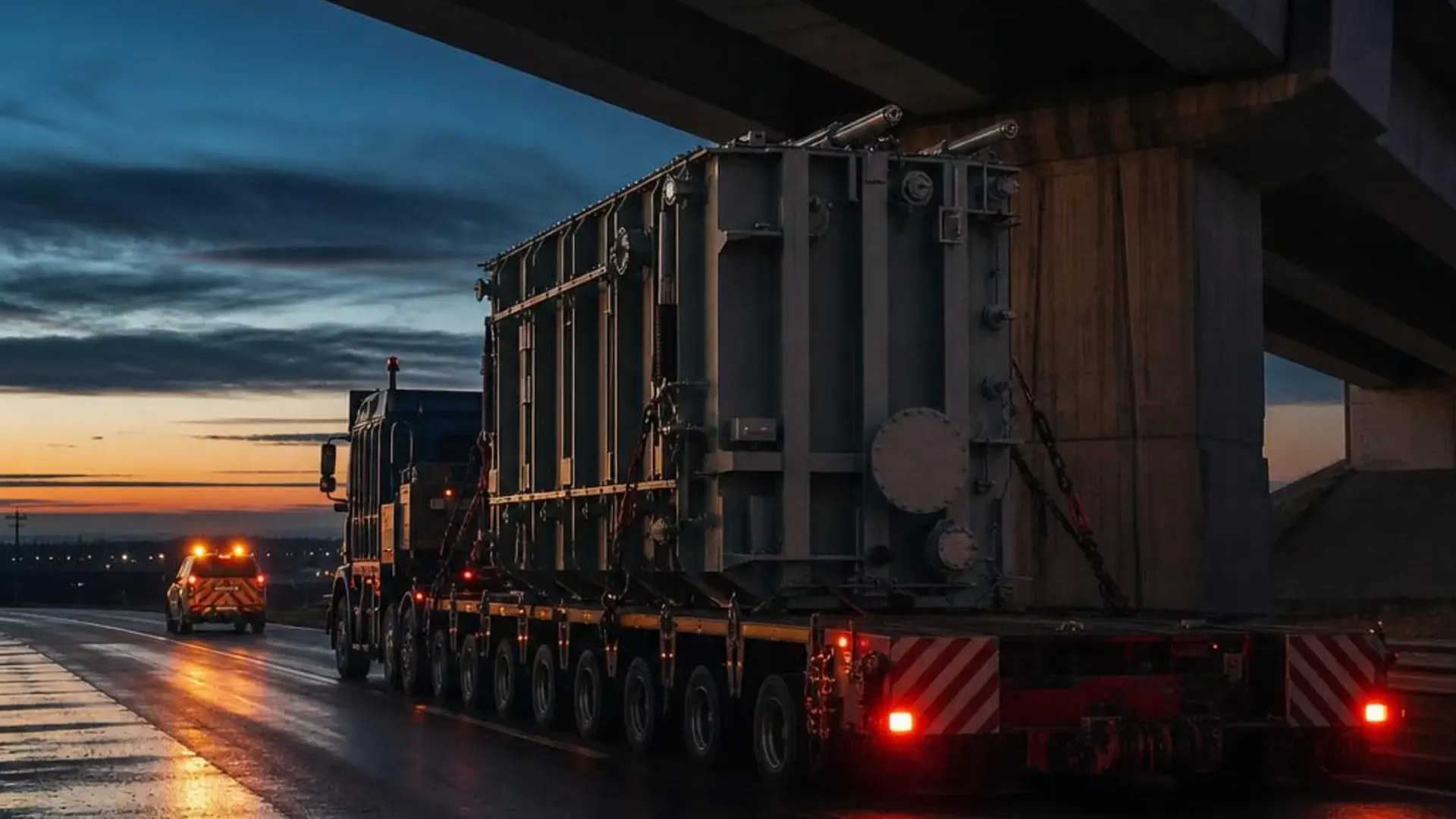
LiDAR Route Survey System for Oversize & Heavy Haul
MeasurePROCapture. Document. Deliver.
A vehicle-mounted LiDAR system and a rugged field tablet, built as one. Clearances, 360° evidence and GPS position are captured together at highway speed — then synced to RoadScope.
MEASURE IT. · MeasurePRO by SolTec Innovation

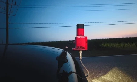 Mounted LiDAR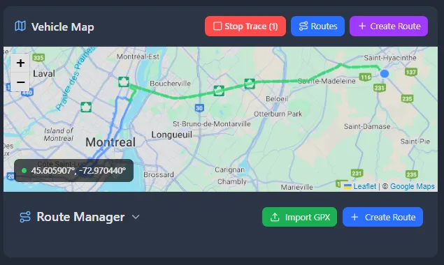
±2 mm
sensor accuracy
SolTec 2D LiDAR, 0.2–250 m
100 km/h
highway-speed capture
operational speed — no stopping
360°
synchronized evidence
camera frame stamped with each reading
RoadScope
synchronization
surveys sync when back online
Offline
field operation
no connectivity required
One obstruction. One chain of evidence.
Follow a single measured clearance from the road to the report.
Nothing is retyped. The height the laser reads is the height in the deliverable.
- Sensor
- SolTec 2D LiDAR
- Sensor accuracy
- ±2 mm
- Range
- 0.2–250 m
- Safety
- Class 1 eyesafe laser
Real interface
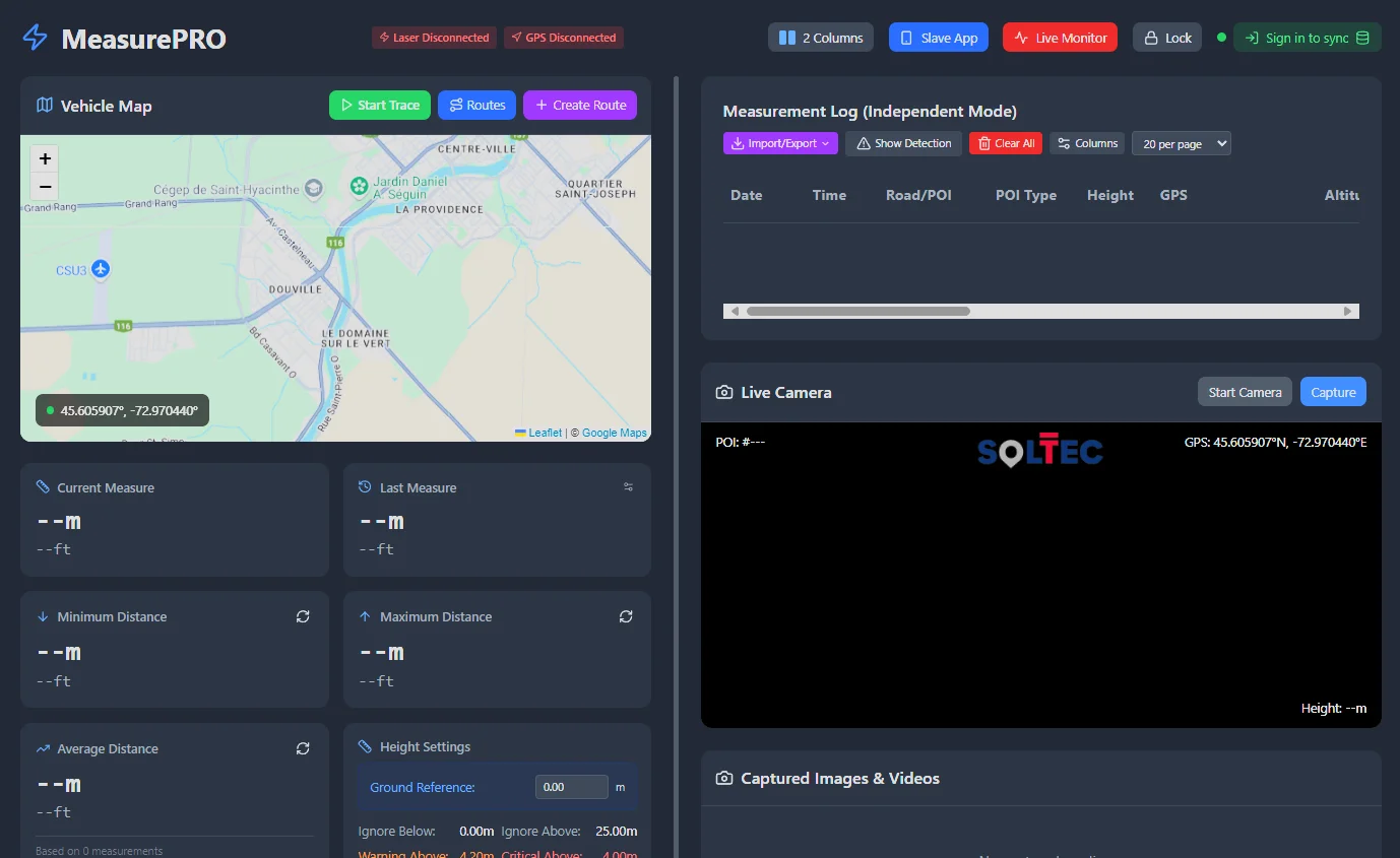
The software your crew will actually use.
Actual captures from MeasurePRO and ProfilingPRO — not renderings.
Complete hardware package
A physical field system, not just an app.
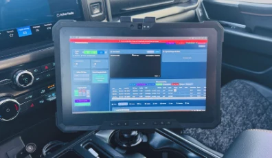
MeasurePRO ships as one integrated kit: sensor, cameras, positioning and the rugged PC it runs on — installed, integrated and trained.
- LiDAR sensorSolTec 2D laser measurement system — ±2 mm sensor accuracy, 0.2–250 m
- 360° camera kitCamera evidence synchronized with each measurement
- GPS/GNSSDual GPS module; Swift Navigation Duro RTK supported
- Rugged PCNative Windows 10/11 (64-bit) application on a rugged tablet, MeasurePRO pre-installed
- Built for the roadClass 1 eyesafe laser, IP67-rated housing
Capture→Verify→Analyze→Prove
01
Capture
Laser clearances, 360° imagery, GPS position, POIs, photos, notes and voice notes — at traffic speed.
02
Verify
Every reading is paired with a stamped camera frame and coordinates, so a number is never alone.
03
Analyze
Synced to RoadScope, measured clearances are compared with the load height along the planned route.
04
Prove
Reports and exports (CSV, JSON, GeoJSON) carry the same evidence chain into the permit file.

RoadScope integration
Measure what is actually there. Then plan with confidence.
MeasurePRO captures the truth on the ground. RoadScope turns that reality into route intelligence: load-height comparison along the planned route, conflicts flagged, reports built from the field evidence.
- Measurements, POIs, stamped photos and the route trace sync as one survey
- Offline first — nothing is lost without coverage
- Same data object from the field to the permit file
The SolTec ecosystem
One route. One truth. One ecosystem.
MeasurePRO owns MEASURE IT. — the field data every later stage depends on.
- MEASURE IT.
MeasurePRO · ProfilingPRO
Field capture of verified route measurements.
You are here - MAP IT.
RoadScope · SweptPRO · LoadPRO
Turn field capture into route intelligence.
- MOVE IT.
SolTecNAV · Convoy Guardian
Execute the permitted route with the load.
- PROVE IT.
Reports · Permits
Evidence and deliverables from the same data chain.
RoadScope, SweptPRO and the other stages are separate SolTec Innovation products — see the full ecosystem.
Trusted by heavy transport professionals
- DTEQ Americas
- DTEQ Europe
- Boralex
- Nordex
- Oxbo
- Landriault Transport
- Rangeland
- Nova Permits
- AXYS Permits
- ODS Equipment
- SolTec
Route surveyors, carriers, engineering firms, permit specialists, project owners and pilot-car teams — in North America, Europe and on project-cargo corridors worldwide. See who uses MeasurePRO
Why change
MeasurePRO versus traditional survey methods
| Task | Traditional field survey | MeasurePRO |
|---|---|---|
| Measuring a clearance | Stop, set up a pole or rangefinder, read, write it down | Read from the moving vehicle by the LiDAR; logged automatically |
| Evidence | Separate photos, matched to notes later | Camera frame stamped with height, time and GPS at capture |
| Positioning | Hand-written location or a phone pin | GPS/GNSS position recorded with every measurement and POI |
| From field to report | Retyping and re-matching in the office | Sync to RoadScope; exports straight from the survey |
| Connectivity | — | Works fully offline; syncs when back online |
Package, training and support
MeasurePRO packages
Choose MeasurePRO, add ProfilingPRO, or equip the convoy with ConvoyGuardian. Scope, delivery and training are quote-confirmed.
- LiDAR survey system
- MeasurePRO software
- 360° camera kit
- Required field hardware and integration
See it on a real road first.
A live road demonstration on a route you care about, with the people who build the system.
Book a Demo Packages & pricingFrequently asked questions
What is MeasurePRO?
MeasurePRO is a LiDAR route survey system for oversize and heavy haul. A vehicle-mounted SolTec LiDAR sensor and rugged Windows tablet capture bridge, wire, and obstruction clearances at highway speed, with synchronized camera evidence and sync to the RoadScope analysis platform.
How accurate are the measurements?
The SolTec LiDAR 2D laser system measures with ±2 mm accuracy across a 0.2–250 m range, using a Class 1 eyesafe laser in an IP67-rated housing.
How do I buy MeasurePRO?
MeasurePRO is delivered as a complete hardware package — LiDAR sensor, GPS module, rugged tablet with software pre-installed, mounting kit, and training. Contact us for a quote tailored to your fleet.
Can I see it working before buying?
Yes. Book a live road demo on a real route, explore the interactive in-app demo with simulated data, or walk through an example route survey — no account required.
Does it work offline?
Yes. MeasurePRO is a native Windows application that works fully offline in the field and syncs surveys to RoadScope when you are back online.
Where is MeasurePRO used?
MeasurePRO is a global system. Teams use it for oversize and heavy-haul route surveys in North America, abnormal-load and exceptional-transport route reconnaissance in the UK and Europe, and project-cargo and OOG corridor assessment worldwide.
What if I want the survey done for me?
MeasurePRO from SolTec Innovation is the technology for teams that build the capability in-house. If you prefer a done-for-you route survey or heavy-transport consulting, SolTec Consultant (soltec.ca) can execute the work for you.